What's new in Sailaway III
Sailaway III
Sailaway III is a virtual sailing environment. A realistic simulation of sailing in all it's complexity. With virtual sailboats, online races and actual weather conditions. It entails the entire world.
This descriptions also applies to its predecessor Sailaway II, but in version III this is taken to a new level. More intense and better in every way. Sailaway III is created from scratch with the knowledge gathered with versions I and II. A bold move, that took many years of development and I can't tell you how proud I am.
Boat designer
Instead of default boats that are the same for everyone, Sailaway III comes with an advanced boat designer. Sailors can upload and create their 3D models and Sailaway will fill in the hard bits.
A boat has many moving parts and those moving parts may even have other moving parts attached to them. The new boat designer takes care of this and makes sure that everything behaves naturally and in accordance with the sail settings and the trim of the boat.
When you move over the deck, the contour of the boat has to be followed. This is usually done my collider meshes. The new boat designer can generate those collider meshes for you.
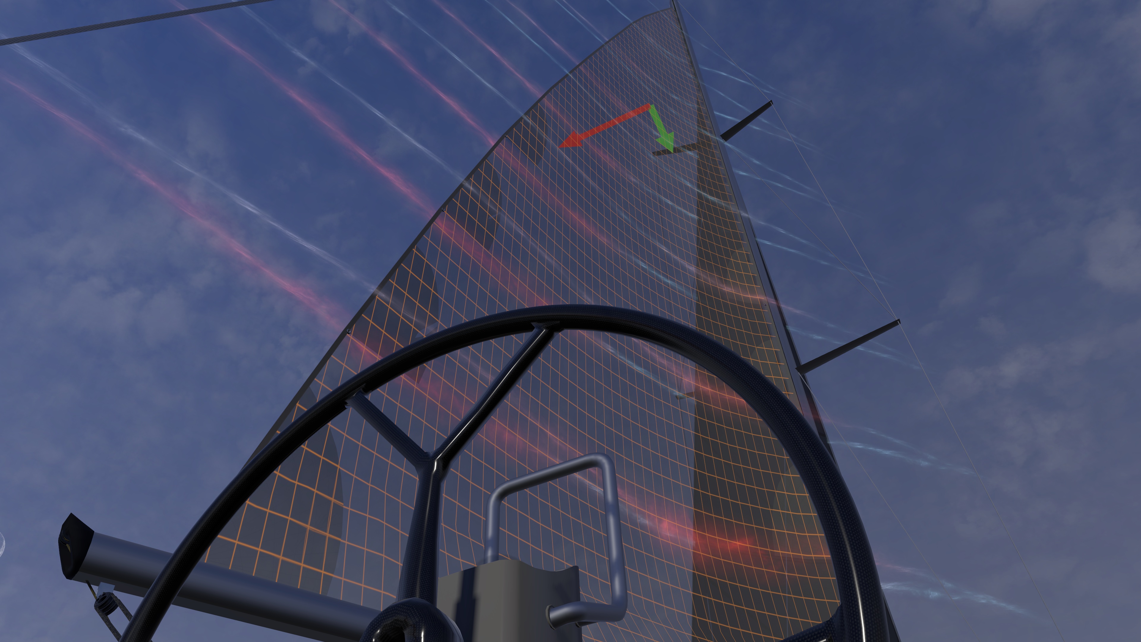
The sails of your boat need to be able to flap when the boat is in irons and they need to represent the actual shape of the sail as set by the trim lines and the bending of the mast. There is a sail designer present inside the boat designer that makes sure your sails will function like you would expect.
How the boat sails is computed automatically based on the shape of the hull and everything that is attached to it (sails, foils, etc). Sailaway does the math needed to predict the behaviour and speed of the boat. It incorporates the actual forces in the sails, the water drag, wind drag, the lift generated by the hull, the sails and the foils, rudder drag, etc. Every force that also operates on a real boat is taken into account and results in speed, heel, lift and maneouvrability.
Sail trim
The flow of air along the sails is computed and simulated in real-time. This will result in a force and that force is used for the calculation of boat speed, heel, etc.
There is no ideal setting, no hidden presets, nothing like that. If you want your boat to go fast, you need to trim the sails to give maximum power, while maintaining a laminar flow at an ideal angle. Just like in the real world. With one important difference: In sailaway you can make the air visible and actually see how it flows around your sails.
This creates a unique experience and a fantastic learning environment. You can experiment as much as you like with different line tensions, different deck layouts and even differently cut sails.
Enhanced graphics
All shaders have been updated to the latest possibilities. The sea, the boats, the buildings and the land look much better on all hardware
When boat surfaces get wet by spray or rain, they will either be covered in droplets (smooth surfaces), become shiny (rough surfaces) or show dark speks (a teak deck).
Customizing boats with your own colors and textures is much easier.
The sky is consists of many layers of different clouds, like cirro-stratus, cirro-cumulus, alto-cumulus, etc. Each cloud layer sits at it's own altitude above the sea. The cumulus clouds are now 3D and respond to the light angle and light color coming from the sun.
Rain and snow look more realistic and there may be occasional lightning flashes/bangs as well.
World designer
It has become very easy to add or edit a sea mark like a buoy or light or the change the water depth in a port. Ports and coastal areas can be edited and decorated with many standard objects or with your own custom models. There is automatically generated vegetation that can be edited easily.
There is only one world, so all edits are applied to all sailors. The experience is that sailors are responsible people, but in case something does go wrong there are sailors with the authorization of "guardian" who are able to remove any unwanted edits.
New features
Tidal waterlevels are automatically applied everywhere you go. With a bit of help from the sailing community the tidal currents will be applied as well.
There is now a non-GPS mode in which the sailor has to rely on a magnetic compass and celestial navigation. The magnetic compass points to the magnetic north as measured on your boat (declination and deviation)
Food and water provisions are kept and reduced daily according to the temperature and weather conditions. Taking in a lot of food and water will the boat heavier and slow it down. Underwater growth is also gradually added on your journey and will have a negative effect on boat speed as well.
Boat speeds for offline sailing will be custom for your boat and your skills. To make your boat go fatser when you sail offline you need to "train" it (and yourself) by trying to sail as fast as possible.
When boat surfaces get wet by spray or rain, they will either be covered in droplets (smooth surfaces), become shiny (rough surfaces) or show dark speks (a teak deck).
Customizing boats with your own colors and textures is much easier.
You can customize the trimlayouts and fittings to your own liking. The sails will respond accordingly.
The sky is consists of many layers of different clouds, like cirro-stratus, cirro-cumulus, alto-cumulus, etc. Each cloud layer sits at it's own altitude above the sea. The cumulus clouds are now 3D and respond to the light angle and light color coming from the sun.
Rain and snow look more realistic and there may be occasional lightning flashes/bangs as well.
Steam
Do you have a Steam account? Please go to the Steam Store and put Sailaway III on your wishlist.